![]()
MARINE CHARTS: Add low-cost official charts in the app (Options button). Seamless quilted charts automatically move from one to the next. Raster charts based on the paper versions, or fast-loading vector charts from Navionics. Worldwide Navionics vector charts: If you have a Navionics subscription, you can use your charts here. Also shows tide and current. US$10.50, €10.50 New Zealand: Official LINZ raster charts including Antarctica and the South-West Pacific. NZ$17.99 US NOAA regions: Raster charts of Atlantic coast (incl. Bahamas & Cuba), Pacific coast, Gulf coast, Great Lakes, Alaska, USVI & Puerto Rico. US$15.99 Canadian regions: Raster charts of Atlantic coast, Great Lakes - Manitoba - Arctic, Quebec, and Pacific coast. C$19.99 UK charts: All of the official raster charts for England, Scotland & Ireland. £13.99 Free: Aerial photos and land maps of the entire world. |
![]()
1-minute demo:
How to see your optimal tacks
and Tacking Time to Destination.
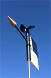
![]()
How to use the
Sailtimer app with the
SailTimer Wind Vane™.
As used in
![]()
NauticEd beginner to advanced sailing courses.
Wouldn’t it be nice if you could simply display the exact tacks to get you there fastest?
SailTimer: Optimal Tacks and TTD®
Sailboats often tack to their destination, which affects the distance and travel time. The SailTimer™ tacking calculations were developed beginning in 2005 because GPS chartplotters didn't know how far your tacking route would be. But if they didn't know that distance, how could they calculate the ETA correctly? The SailTimer tacking results solved this problem, and set a new standard.
The SailTimer app provides an instant display of your optimal tacking route, distance and Tacking Time to Destination (TTD ®). It can also learn polar plots for your individual sailboat's performance in all wind speeds and directions, to provide more precise tacking results. A live overlay is also now available in the app of crowdsourced wind & race maps.
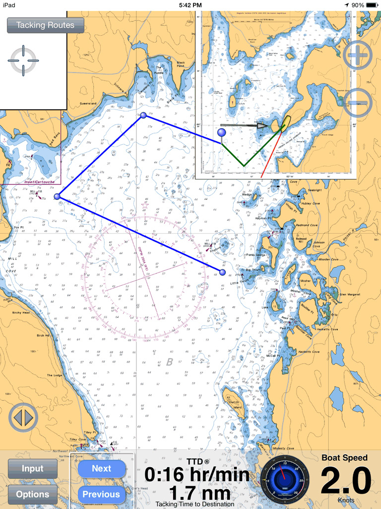
It is often hard to know whether to head off the wind to get more speed (but at a longer distance), or beat closer to the wind to reduce the distance (but at lower speed). Traditionally that is known as The Helmsman's Dilemma. Now, you can use the patented SailTimer tacking results to display your optimal tacks as a chart overlay, and see the precise distance, time and heading on each tack*. No more guessing or superstition to determine the optimal tack, or arriving hours later than you expected.
This may be a low-cost app, but it has sophisticated tacking results. It is kind of ironic that you can generate better tacking results on your phone than on an expensive GPS chartplotter; a sign of the times. Many GPS chartplotters don't have any sailing functions at all. But if the ETA is not accounting for your tacking distances, it is wrong. For decades, the standard response from all of the major manufacturers was to use VMG rather than tacking distances (even though distances are obviously easy to get in a GPS). But VMG calculations are fraught with errors and assumptions, and are usually poorly explained in GPS owners manuals (see VMG link on menu above for further details).
Some GPS chartplotters and mobile apps are now trying to catch up, and have started displaying laylines based on your tacking angle. That is an antiquated method from before GPS and personal computers even existed. The first problem with this is that your tacking angle varies with wind speed. In stronger winds, you can point much higher to the wind. They may therefore allow you to import polar plots of boat speed (if you can obtain your polars anywhere other than in the SailTimer app) to create different tacking angles for different wind speeds. But generic, one-size-fits-all polar plots for all boats of the same model do not give you accurate results. They treat a clean, empty racing boat with new sails the same as a cruising boat with bagged out sails, moss growing on its waterline, and lots of anchors and canned goods on board. The polars would be very different for those two boats even though they are the same model. SailTimer Inc. pioneered polar plot learning, but that is not available in any GPS chartplotter.
Fortunately, the SailTimer app simplifies all of this. It can use default polar plots or can learn custom polar plots for your individual sailboat. It lets you plan your tacking route and TTD® (Tacking Time to Destination) even while still at the dock.
If you are wondering how long it would take to drive a car 100 miles at 50 miles per hour, you would divide the distance by the speed. 100 / 50 = 2 hours. Simple. There would be no reason to try to figure out the ETA (or optimal route) without the distance. Obviously that is not going to be accurate. But for sailing, that is the way it has always been done on GPS chartplotters.
In contrast, the SailTimer system is unique in using tacking distances to define your optimal tacks and Tacking Time to Destination. Boat speed (from polar plots) and tacking distances (from GPS) define the optimal tacks and the TTD (Tacking Time to Destination). For a full illustration of the logic, see this case study. This is a fundamental new paradigm for sailboat navigation and racing. In short, Distance / Speed = TTD.
The SailTimer app can display the optimal tacking distances, headings and times in all wind speeds and directions, for both the port and starboard tacks and each individually. It gives you a quick and easy display of your optimal tacks and Tacking Time to Destination (TTD ®).
*US Patent No. 8,135,504 B2. Australia Patent No. 2007236513. European Patent No. 2 013 576.
|
|
|

|
Update tacking results automatically as the wind changes, with our solar-powered, wireless anemometer. |
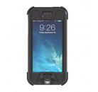
Waterproof hardcases for your tablet or smartphone: Lifeproof, Griffin, Lifejacket, and LifeEdge. Hardcases with mounts: Hitcase, Dog and Bone. |


Copyright 2005-2018 (c) SailTimer Inc.